
A Visualization of Sunrise and Sunset Photos Being Snapped Around the World
- by 7wData
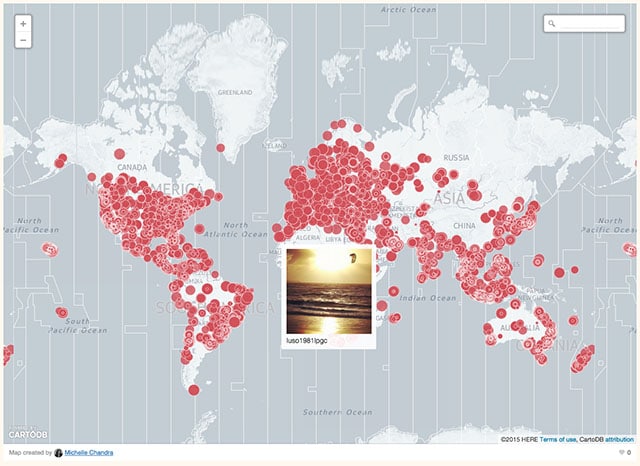
“All Our Suns” is a new project by NYC telecommunications grad student Michelle Chandra that visualizes the snapping of sunset and sunrise photos around the world using Instagram data. Chandra has released three interactive maps using data gathered from monitoring Instagram for 24 hours. The first tracks sunlight across the face of the Earth by looking at when people are snapping sunrise and sunset shots (and tagging them #sunrise and #sunset on Instagram):
A second pair of maps let you browse a giant collection of sunrise and sunset photos on zoomable world maps.
Finally, a third animated map lets you see every time someone posts a sunset photo at the exact time someone else on Earth posts a sunrise photo.
“Instagram users reveal a different idea of time, a richly textured irregular time in which the setting Sun and end of the day for one individual is the beginning of the day for another, a never-ending loop.”
[Social9_Share class=”s9-widget-wrapper”]
Upcoming Events
From Text to Value: Pairing Text Analytics and Generative AI
21 May 2024
5 PM CET – 6 PM CET
Read More